AI-Powered Cars Are Now Detecting Potholes Before Drivers Even See Them
AI‑based pothole detection relies on combinations of: Dashcams and in‑car cameras
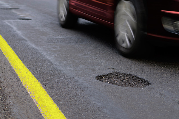
A generation ago, cars existed mostly to move people from point A to point B. Today, connected, AI‑enabled vehicles are becoming vast fleets of mobile road‑inspection robots—constantly scanning for potholes, cracks, and other road defects, then feeding that data back to governments, cities, and mapping platforms. Rather than just avoiding potholes for the driver in front of the windshield, these cars are now logging and reporting potholes for every driver who will ever use that road.
How AI “Sees” Potholes in Real Time
AI‑based pothole detection relies on combinations of:
-
Dashcams and in‑car cameras
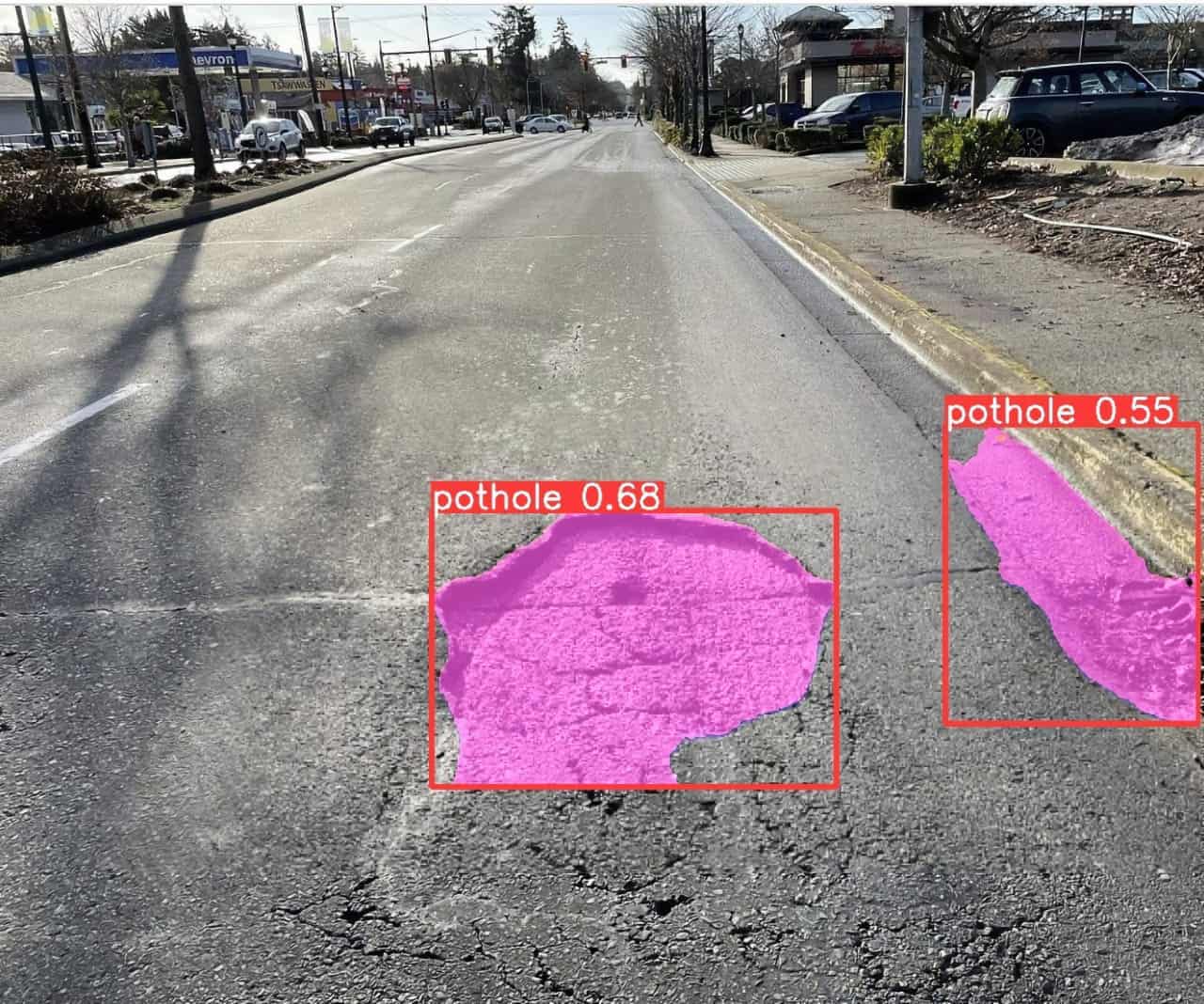
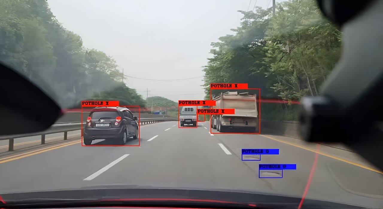
- Cameras mounted on the windshield or bumper stream video of the road ahead.
- Computer‑vision models (often YOLO‑style object‑detection or segmentation networks) scan each frame for irregularities, shadows, and shape patterns typical of potholes.
-
Lidar and sensor fusion
- In more advanced test vehicles, AI bins lidar sweeps, radar, and IMU readings to distinguish between:
- A “soft” bump (speed breaker, manhole lid)
- A true pothole or deep crack
- Honda has pilot systems that achieve around 89% accuracy in detecting potholes and other road defects using this data‑fusion approach.
- In more advanced test vehicles, AI bins lidar sweeps, radar, and IMU readings to distinguish between:
-
On‑the‑fly mapping dashboards
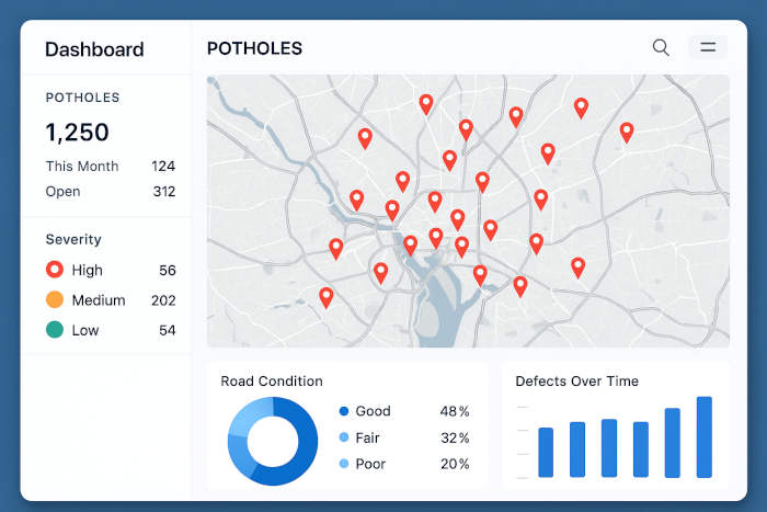
- Some platforms show a map‑style dashboard where:
- Each detected pothole gets a geotag and severity score
- Agencies or fleet managers see heat‑maps of the worst‑affected roads
- Examples include AI‑driven tools like RoadLens and CITYROVER, which can turn car fleets into “road‑survey robots.”
- Some platforms show a map‑style dashboard where:
In short, AI doesn’t just “see” potholes; it classifies, geotags, and scores them for maintenance teams.
Connected Cars as a Crowdsourced Sensor Network
What makes this powerful is the scale of connected‑car fleets:
-
Fleets that never sleep
- Ride‑hailing vehicles, buses, trucks, and patrol cars generate thousands of kilometers of road‑video per day.
- Instead of sporadic human inspections, AI can run continuous, 24‑hour road‑surface monitoring from naturally moving vehicles.
-
Government‑backed crowd‑mapping pilots
- India’s National Highways Authority (NHAI) is deploying AI‑powered dashcams on 40,000+ km of highways, using AI to detect potholes, cracks, and other defects from video streams.
- The system is designed to flag issues so repairs can be scheduled before roads become dangerous or need full reconstruction.
-
Research‑grade prototypes on real‑world roads
- A team in Hyderabad built an autonomous electric vehicle that can detect around 80% of potholes in real time using cascaded deep‑learning models (YOLOv9, DeepLabv3+, etc.).
- The research is designed not just for self‑driving safety, but to log pothole locations into a central map that can warn other cars and inform city planners.
All of this means that every AI‑equipped car can function as a small sensor node in a city‑wide road‑health network.
Why Car‑Makers, Cities, and AI‑Tool Publishers All Win
This shift is economically and socially attractive:
-
For governments and highway authorities
- NHAI and agencies like Ohio’s DOT hope to:
- Cut repeated repairs by fixing potholes earlier.
- Save millions of dollars in road‑maintenance budgets.
- Deploy crews based on data‑driven severity maps, not political complaints.
- NHAI and agencies like Ohio’s DOT hope to:
-
For car‑makers and autonomy researchers
- Identifying potholes helps:
- Active‑suspension and chassis‑control systems decide when to stiffen or soften.
- Autonomous‑driving stacks plan smoother, safer trajectories around damage.
- Some systems even learn road‑quality profiles so cars can “know” what to expect on a stretch they’ve driven before.
- Identifying potholes helps:
-
For AI‑tool and AI‑news publishers
- The “AI‑driven pothole detection” stack has many moving parts:
- Computer‑vision models (YOLO, segmentation nets)
- Edge‑AI inference on dashcams and Raspberry‑Pi‑class hardware
- Cloud‑based condition‑mapping and heat‑maps
- Automated prioritization dashboards for cities and fleets
- Writers can track:
- Which models and architectures are becoming “standard” (e.g., YOLO‑variants, DeepLab).
- How cities are rolling out AI‑road‑inspection pilots (India, U.S., Korea, Europe).
- How AI‑tool vendors are packaging this as out‑of‑the‑box “road‑condition” APIs for governments and fleets.
- The “AI‑driven pothole detection” stack has many moving parts:
What This Means for the Future of Driving
AI‑equipped connected cars are quietly reshaping the relationship between drivers, cities, and infrastructure:
-
Cars that “complain” on your behalf
- Instead of waiting for a pothole to warrant a complaint form, your car can automatically flag it, geotag it, and notify the authorities.
- Honda’s “Proactive Roadway Maintenance System” already sends anonymized defect data to the Ohio Department of Transportation, helping planners target the worst‑affected roads.
-
Personalized, AI‑driven comfort and safety
- AI can learn which roads are rough and which are smooth, then:
- Suggest smoother routes
- Adjust suspension and driving modes in real time
- Warn drivers about upcoming hazard zones
- AI can learn which roads are rough and which are smooth, then:
-
AI‑as‑the new city engineer
- Over time, AI‑driven road‑condition systems can:
- Predict which roads are likely to fail next, based on historical wear.
- Simulate repair‑budget scenarios and suggest optimal spending plans.
- City planners may start treating AI‑driven pothole data as a core infrastructure KPI, not a side project.
- Over time, AI‑driven road‑condition systems can:
FAQ
How does AI know what’s a pothole versus a crack or speed bump?
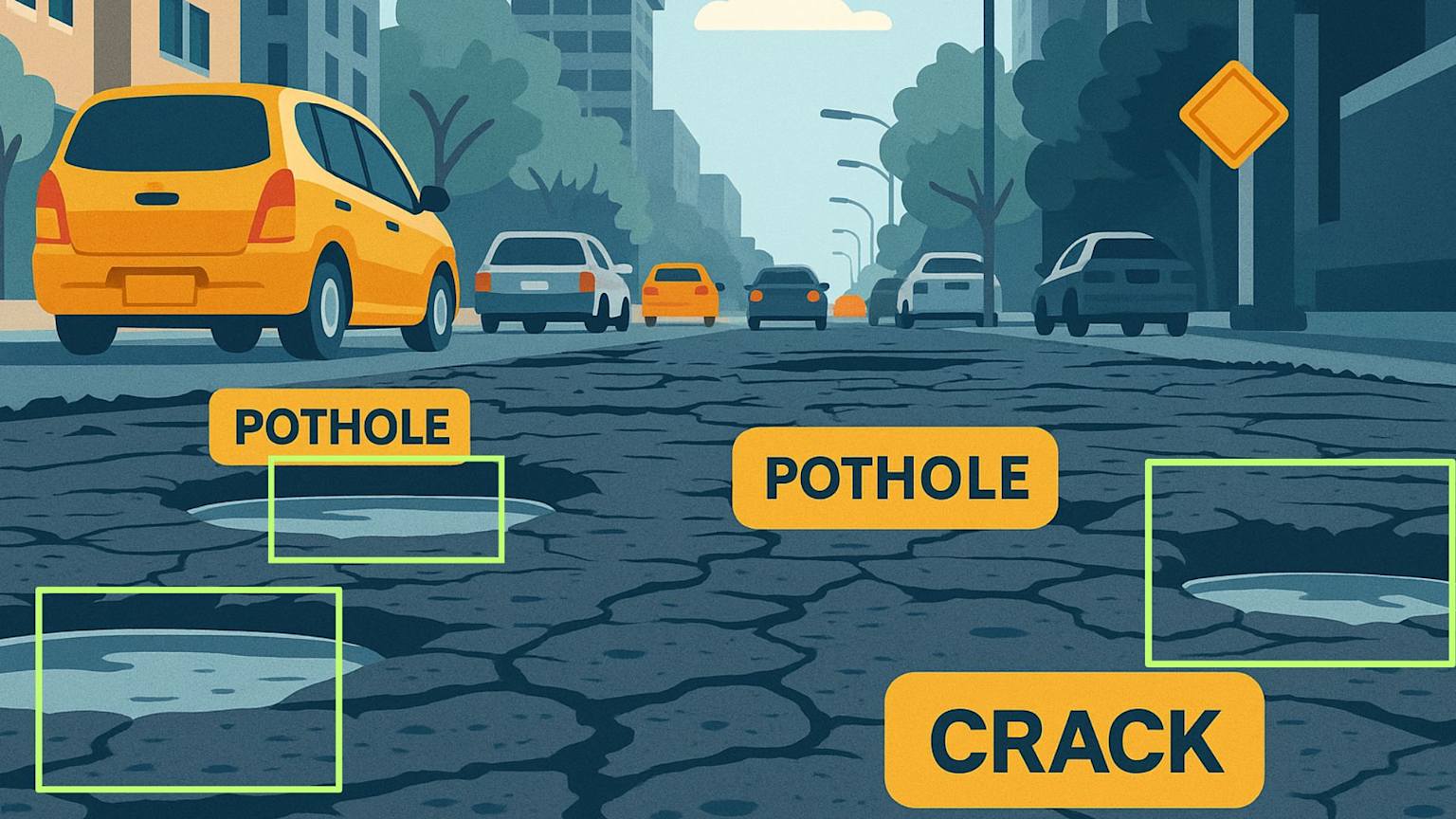
AI models are trained on thousands of labeled images and videos of roads, learning to distinguish:
- Potholes (deep, irregular depressions)
- Cracks and fractures
- Speed bumps and manhole covers
Many systems use object‑detection nets (like YOLO) or semantic segmentation models (like DeepLab) tuned to road‑surface patterns.
Do cars actually send pothole data to governments?
Yes. Pilots such as:
- Honda’s Proactive Roadway Maintenance System in Ohio
- AI‑dashcam programs on Indian national highways (NHAI)
show that cars can upload anonymized pothole and defect data to cloud platforms, which then feed city and highway agencies with actionable maps.
What’s the business model for AI pothole tools?
Several approaches:
- Sell AI‑pothole‑detection software to cities and highway authorities (e.g., NHAI‑style dashcam systems).
- Offer “road‑condition” SaaS dashboards for fleet managers and logistics companies.
- Package AI‑road‑inspection tools as APIs or SDKs for OEMs and mapping platforms.
Why should AI‑tool and AI‑news publishers care?
Because AI‑driven pothole detection is a concrete example of AI turning everyday infrastructure into a sensor‑rich system. It mixes:
- Edge‑AI and computer‑vision
- Real‑time road‑condition mapping
- City‑planning and public‑safety decision‑making
Writers and AI‑tool blogs can use this as a case‑study category for AI in smart‑cities and autonomous‑driving stacks.
Final Thoughts
AI‑enabled cars are no longer just vehicles; they are becoming rolling pothole‑finding machines that quietly log damage, warn future drivers, and help cities fix roads more efficiently. From Honda’s Ohio pilot to NHAI’s AI dash‑cam rollout and Hyderabad‑built autonomous EVs, the pattern is clear: the next wave of AI‑impact is not just in chatbots and image‑generators, but under the tires of every connected car.
For AI‑tool and AI‑news publishers, this is a reminder that the most transformative AI stories often come from unseen, infra‑level changes—and AI‑driven pothole detection is a perfect example of AI turning roads themselves into a live, data‑driven system.